
Sydney harbour is arguably one of the prettiest natural harbours in the world. And it’s huge. Occassionally it’ll be used to give context to a large volume – “This is as big as X Sydney harbours!”, but I don’t think anyone really knows what that means. Just that it’s big…
Anyway, one big plus about Sydney harbour is that large chunks of the waterfront is open to the public, and much is natural bushland. Recently, effort has been made to link up existing walking tracks to make a continuous walking track from Bondi beach to Manly beach.
The walk itself is about 80km long, and includes crossing the iconic Sydney Harbour Bridge. The walk can be done from either direction.
The start and end were logical markers, given both these beaches are well-known and big drawcards to the city. However, there’s also options to extend the walk in either direction. There’s a great option from Bondi to Maroubra, so we included this section as the first part of our walk.
It’s hard to get “lost”, given you’re in one of the world’s largest cities, but there’s definitely a lot of spots where the path/road is not clear. The Bondi to Manly website recommends using their app for navigation, which was definitely a good idea

Bondi to Manly map – we added an extension to Maroubra (bottom right)
Day 1: Maroubra to Bondi (12km)
Our first day is technically not on the Bondi to Manly walk, but is definitely worth adding to the journey. It has dramatic coastal scenery and a number of beautiful beaches such as Maroubra, Coogee and Tumbarumba.


Walking on this day is quite easy and a good introduction to the walk. There’s some hills going up and down between headlands and beach, but it’s mostly on well-formed concrete paths.
It does get very busy though! Especially on sunny days


Day 2: Bondi to Rose Bay (21km)
One feature with an urban walk like this, is that there’s a lot of flexibility on where each day starts and ends. We reached Bondi by 1pm yesterday, so decided to push onto the Gap and make it a 20km day – it meant today would be a much easier 12kms, and give us time to get back to watch the end of the Sydney Marathon runners finishing.
By finishing at the Gap on day 1, it made for an easy 250m walk to the Watsons Bay ferry terminal.


Heading North from Bondi, the route moves away from the coast around the golf course (premium land!) The number of walkers through this section is significantly less than south of Bondi, but picks up again around the Gap.
From the Gap the route passes near the naval base and up to South Head and the Hornsby lighthouse. It’s incredible to know there’s about 70km of walking to go to reach the North Head – it seems so close!


Between Watsons Bay and Rose Bay there’s the picturesque Parsley Bay bridge and a nice bush-walk between Bottle and Glass Point and Rose Bay.
Through here is also Vaucluse House, plus an opportunity to admire some very impressive houses!


Rose Bay is a good finish point for the day, due to the regular ferry service back to Circular Quay
Day 3: Rose Bay to North Sydney (19km)
Today is probably the most iconic day, due to the crossing of the bridge.
Starting in Rose Bay, the walk first goes through the mansions of Point Piper. Glimpses of the harbour between houses indicates why this area is so popular!
Moving through Double Bay and Rushcutters Bay, the landscape reflects the inner city preference for denser living and becomes more urbanised. The Botanic Gardens provides a nice respite from the city, and provides great views of the Opera House and bridge


Circular Quay and the Rocks were very busy (as always!), but also impacted by the marathon the day before and the imminent departure of a cruise-ship.
From the Rocks, the walk heads up and over the bridge and into North Sydney. Definitely quieter on the northern side!
After passing Kirribili house, the plan was to stop at North Sydney wharf, but we decided to push on to Neutral Bay wharf to shave off a few km’s the next day. By doing so we also avoided about 200 steps first thing in the morning!


Day 4: North Sydney to Spit bridge (20km)
Moving away from Sydney, there’s a series of large peninsulas first up. Cremorne is probably the most interesting, as there’s a 3km thin strip of bushland that lines the coastline around the point. Apparently it was decided when opening up the area that the first 100ft from the waterline had to remain public land. It’s a beautiful area


From Cremorne, the walk then moves through Mosman and past the zoo. From Mosman, the trail returns to bushland and becomes quite peaceful. You wouldn’t realise you’re still in the middle of such a large city!
The Sydney Harbour National Park covers most of the rest of the trail to Manly from here


Middle Head is a fascinating spot to spend some time exploring. It was set up with a defence battery to attack enemy ships that entered the harbour. It was part of a comprehensive defense network. Many of the gun emplacements, defensive channels and observations posts remain.
Walking around Sydney harbour it becomes apparent how much of the waterfront is assigned to military and defence installations. At the time, many of these locations were quite remote, but the city has grown over time and consumed them. Some spots (such as the Penguins submarine base) have been rehabilitated into public spaces


From Middle Head the route heads along Balmoral Beach and up to the Spit to finish the penultimate day. The Spit Bridge is a key link for the people living north of it – there’s not a lot of other road options to get down to the rest of Sydney without a long diversion!
There’s regular buses along this route to get back to the city


Day 5: Spit Bridge to Manly (20km)
The final day is one of the most scenic. The first half completes the journey through the Sydney National Park to the Manly wharf. The second half loops up and around the North Head, finishing on Manly beach. It’s only 200m from the beach back across to the ferry terminal


After crossing Spit Bridge, we crossed Clontarf beach and were back into the Sydney Harbour National Park.
The trail follows the bushland through to the outskirts of Manly, and is very different to the bushland further into the harbour. The plants are much more coastal and vegetation more sparse, due to the prevailing winds.


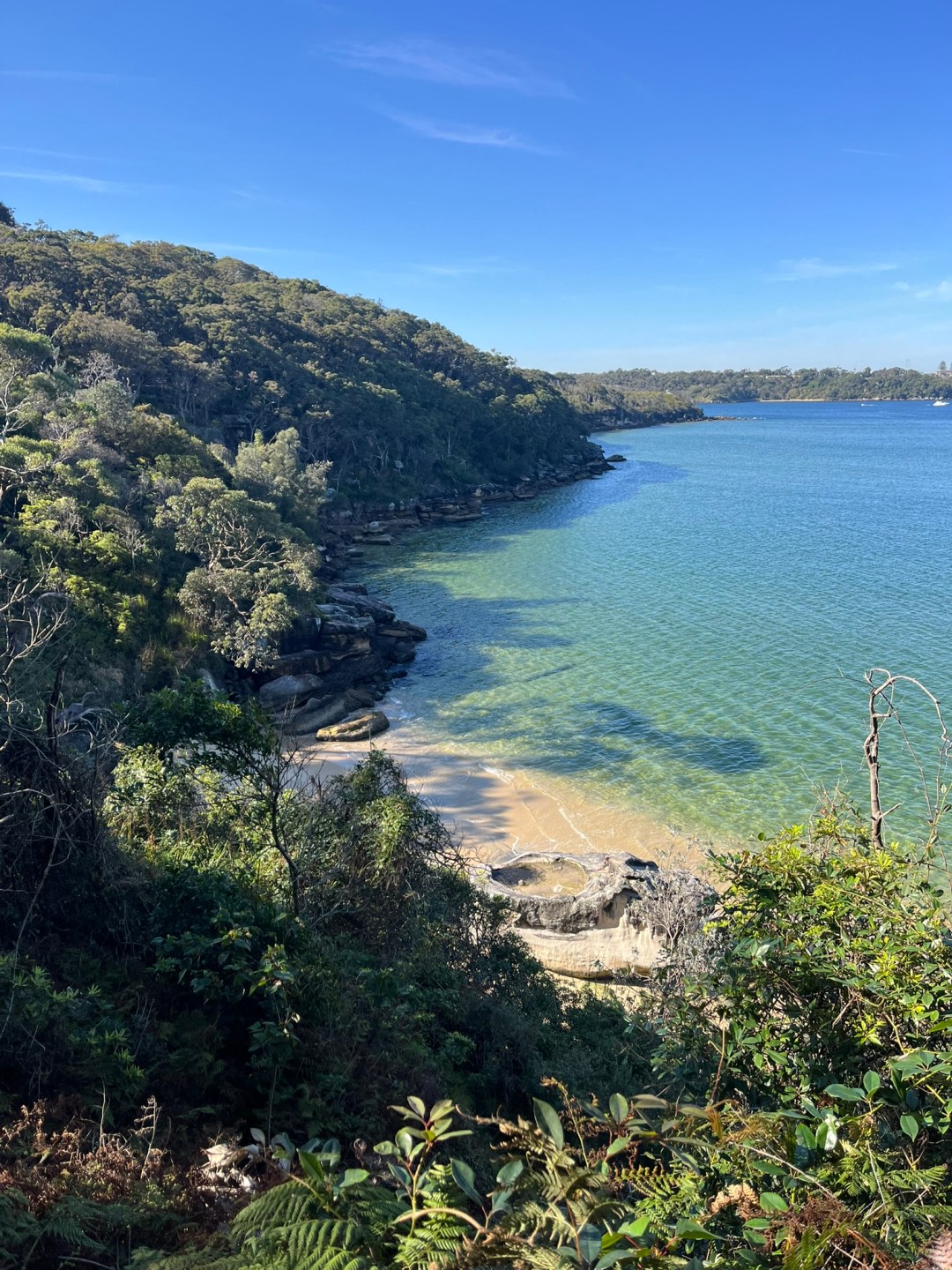

After passing the Manly ferry terminal, the trail heads up into the North Head via Collins Beach. There’s a lot of small beaches throughout the harbour, but this one was particularly scenic. It even has a waterfall!


North Head has an old quarantine station and remnants of military defence (no surprise by now). Most of it is part of the Sydney Harbour National Park.
The highlight was reaching the head, and looking back at the South Head we had been at only a few days (and 70km!) ago… Having walked the route, landmarks became easy to identify


After North head, there’s a relatively short walk via Shelly Beach to the finish at Manly Beach. With the coastline exposed to the open ocean, the coastline in this section is very rugged


The Bondi to Manly walk is an excellent harbour walk that truly showcases Sydney’s magnificent harbour. It’s relatively easy, however there is more elevation gain than you’d first expect.
Public transport makes it easy to start/ stop each day from a central base, but be aware that some sections are relatively remote and access points are limited (particularly in the northern section).
Stay somewhere in central Sydney, and each day can easily be reached by transport in less than an hour!
